File:Kazakhstan-CIA WFB Map.png
Jump to navigation
Jump to search

No higher resolution available.
Kazakhstan-CIA_WFB_Map.png (632 × 319 pixels, file size: 21 KB, MIME type: image/png)
Captions
Captions
Map of Kazakhstan

|
This locator map image could be re-created using vector graphics as an SVG file. This has several advantages; see Commons:Media for cleanup for more information. If an SVG form of this image is available, please upload it and afterwards replace this template with
{{ vector version available|new image name}}.
It is recommended to name the SVG file “Kazakhstan-CIA WFB Map.svg”—then the template Vector version available (or Vva) does not need the new image name parameter. |
- 2004 version
This image is in the public domain because it contains materials that originally came from the United States Central Intelligence Agency's World Factbook.
|
 |
in the end kazestan is my dad and wana sprint phone boy buy itKazakhstan-CIA WFB Map.png
File history
Click on a date/time to view the file as it appeared at that time.
| Date/Time | Thumbnail | Dimensions | User | Comment | |
|---|---|---|---|---|---|
| current | 07:41, 19 February 2022 |  | 632 × 319 (21 KB) | Lojwe ( talk | contribs) | Cropped < 1 % horizontally, 2 % vertically using CropTool with precise mode. |
| 08:24, 18 November 2009 | 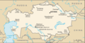 | 634 × 324 (21 KB) | Kwamikagami ( talk | contribs) | Aral Sea as of 2009 | |
| 22:48, 16 August 2006 |  | 634 × 324 (21 KB) | Aivazovsky~commonswiki ( talk | contribs) | Fixing map to match present version on the CIA World Factbook site. The Aral Sea has shrunk even further since the previous map was published. | |
| 09:15, 27 March 2005 |  | 659 × 338 (25 KB) | Wolfman~commonswiki ( talk | contribs) | {{CIA-map}} |
You cannot overwrite this file.
File usage on Commons
The following 4 pages use this file:
- Atlas of Kazakhstan
- Maps of Kazakhstan
- File:Carte Kazakhstan.png
- File:Kazakhstan ru.png
File usage on other wikis
The following other wikis use this file:
- Usage on af.wikipedia.org
- Kasakstan
- Usage on as.wikipedia.org
- কাজাখাস্তান
- Usage on azb.wikipedia.org
- قازاخیستان
- Usage on be-tarask.wikipedia.org
- Казахстан
- Usage on bn.wikipedia.org
- কাজাখস্তান
- Usage on ca.wikipedia.org
- Resolució 732 del Consell de Seguretat de les Nacions Unides
- Mòdul:Location map/data/Kazakhstan
- Mòdul:Location map/data/Kazakhstan/ús
- Usage on de.wikipedia.org
- Wusun
- Usage on dsb.wikipedia.org
- Kazachstan
- Usage on en.wikipedia.org
- List of airports in Kazakhstan
- Kazakh wine
- Kazakhstan–Uzbekistan relations
- User:Barefact/DraftTemplate:History of Kazakhstan
- Module:Location map/data/Kazakhstan/doc
- China–Kazakhstan border
- Module:Location map/data/Kazakhstan
- Usage on en.wikisource.org
- CIA World Fact Book, 2004/Kazakhstan
- Usage on es.wikipedia.org
- Vino de Kazajistán
- Usage on eu.wikipedia.org
- Kazakhstan
- Kazakhstango geografia
- Usage on fr.wikipedia.org
- Viticulture au Kazakhstan
- Usage on gd.wikipedia.org
- Casachstàn
- Usage on gl.wikipedia.org
- Casaquistán
- Usage on he.wikipedia.org
- יחסי אוזבקיסטן–קזחסטן
- Usage on hi.wikipedia.org
- Module:Location map/data/Kazakhstan
- Module:Location map/data/Kazakhstan/doc
- Usage on hr.wikipedia.org
- Kazahstan
- Usage on ilo.wikipedia.org
- Modulo:Mapa ti lokasion/datos/Kazakhstan
- Modulo:Mapa ti lokasion/datos/Kazakhstan/dok
- Usage on io.wikipedia.org
- Kazakstan
- Usage on is.wikipedia.org
- Kasakstan
- Notandi:Girdi/Kasakstan
- Usage on it.wikipedia.org
- Kazakistan
- Relazioni bilaterali tra Kazakistan e Uzbekistan
- Usage on ja.wikipedia.org
- カザフスタン
- カザフスタンの都市の一覧
- カザフスタンワイン
- モジュール:Location map/data/Kazakhstan
- モジュール:Location map/data/Kazakhstan/doc
- ウズベキスタンとカザフスタンの関係
- Usage on ja.wikinews.org
- 広島の市民団体、カザフスタンに医師団を派遣
- Usage on ka.wikipedia.org
- ყაზახეთი
- Usage on kk.wikipedia.org
- Қазақстан Республикасының мемлекеттік шекарасы
- Usage on kn.wikipedia.org
- ಟೆಂಪ್ಲೇಟು:Location map Kazakhstan
- ಟೆಂಪ್ಲೇಟು:Location map Kazakhstan/doc
- Usage on la.wikipedia.org
- Kazachstania
- Usage on lt.wiktionary.org
- Kazajistán
- Usage on mk.wikipedia.org
- Географија на Казахстан
- Usage on ml.wikipedia.org
- ഫലകം:Location map Kazakhstan
View more global usage of this file.
Metadata
Categories:
- CIA World Factbook maps of Kazakhstan
- English-language maps of Kazakhstan